The 7 Wonders of the World

“Okay 2nd graders! Today we are going to put on our best explorer hats and dive into a new map! We’ve been exploring lots of different maps this week and today we are going to look at the 7 wonders of the world.”

“Can anyone raise their hand and tell me what the 7 wonders of the world are?” Wait for student responses.

“Okay class, the 7 wonders of the world are 7 incredible places around the world. We are going to get our iPads out and explore all 7 of them! Ready… Set… Go!” Once students have their iPads out and are sitting quietly, instruct them to open the MyMaps link on their SeeSaw page. Once students have opened the link, give them some time to explore.

“Okay class, so on this map, there are 7 different spots for you to look at! Each spot has some pictures and a really fun video to teach you allll about that wonder of the world. I need you to pay close attention to what you’re learning, because once you’re done exploring, you are going to work with your table group to make your own map teaching us about one of the 7 wonders.”

“Give me a thumbs up if you understand what we’re doing today!”

The teacher will walk around offering guidance as needed or pushing students to think deeper. The MyMaps will give students the chance to learn about each wonder of the world before they choose their favorite, and then to work with a partner to use the details from the video to create a more detailed map of one of the wonders of the world. They can add images, additional videos, and words to the map to teach their classmates even more facts and details about the place they chose.

7 Wonders of the World Map: https://www.google.com/maps/d/edit?mid=10ImFzu5SvhseptaK0EKLlTguGp6qNzae&usp=sharing

US Landmarks Map

This lesson is designed for a 3rd grade social studies class. For this lesson, students will get in groups of 2-4 and create a shared map on Google Mymaps. Then, they will make markers to indicate certain historical landmarks, national parks, interesting cities, or anything else of note within the United States. Once they are done, they will take time to look through all the points that their group members made as well.

After this, they will choose one location that interests them (it can be one that they found or that their group members found) and they will create an informational poster about it. This can be done on paper, or on any site that lets you make posters or brochures. Afterwards, they will share their location to the class and will also share at least one interesting fact they found about it.

The goal for this lesson is to introduce students to researching and presenting on a topic of their choice. The map allows students to not only get a better visual understanding of how the United States is spaced out, but it also allows students to collaborate with each other, and it gives them the chance to share their ideas both with their small groups and with the entire class. I also wanted to give the students freedom as to how they choose to record and present their information to the group, since this sort of a research assignment could be a very new concept to them.

Mapping the Movements

Target Group – 3rd-5th

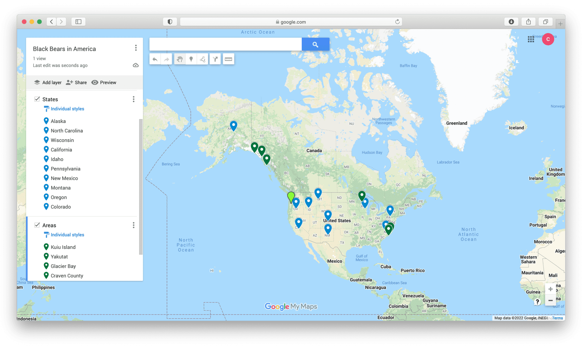
Students will use MyMaps to learn information about a different animal and the places they lived. The reason I put varying ages is because I think third graders could explore a MyMaps that’s already completed on an animal. In fourth grade, the students can choose a place to add to a class MyMaps and in fifth grade they could do their own project on an animal and do the MyMaps on their own. The goal for the lesson is for students to see how the same animal can live in so many different areas.

Mapping the Events of WWII

Grade: 9th

Subject: U.S. History

Goal: Students will use the knowledge they’ve gained in class or will conduct their own research to map out important locations of major events/landmarks of WWII. By using MyMaps, they will be able to visualize the events of WWII on a global scale and organize their information.

Hello class! This coming week, we will start our review on WWII to get ready for our unit test. The assignment for this weekend will be the start of our review using Google My Maps. For this assignment, you will need to create a new Google My Maps (you can create this from your Google Drive by selecting ‘New’ in the top left corner, then pressing ‘More,’ and selecting ‘Google My Maps’). For those that are unfamiliar with this site, here is a link to a tutorial video on YouTube, however, it is relatively easy to navigate through without prior experience.

Your Google My Maps should have at least 5 pinned locations that connect to 5 different important events or places relevant to WWII (ex: decisive battles/attacks, military/naval bases, significant concentration camps, places where treaties were signed, etc.). Each of these pins should have the name, date, and a brief description of the event/landmark with at least 3 facts about it included (I encourage you to do some research on your own, but feel free to also use your notes!). We will be sharing these My Maps in small groups on Monday, so be prepared to present your maps informally. I’m excited to see what you guys come up with!

Example of student work:

Featured Image: Photo by Curtis Reese on Unsplash

In a Rush!

CA CCSS 4.3.2 – Compare how and why people traveled to California and the routes they traveled (e.g., James Beckwourth, John Bidwell, John C. Fremont, Pio Pico).

This activity is designed for fourth-grade students in California. This lesson will be tied into the California history unit on the Gold Rush and Westward expansion. My goal is for students to understand the dangers of the route and consider why pioneers would still embark on the trip.

In this lesson, students will explore a map of the Pony Express Trail on Google MyMaps. Students will move along the trail and do research on the various stops along the way from the East to West on the hunt for gold. They will work together and determine the challenges of traveling through these locations. They will then create an opinion piece on whether or not they would take this trail if they were pioneers.

Field Trip to the Zoo!

Grade: Any elementary school grade – Science

Goal: Students will go on a field trip to the zoo, this map will be shared with parents/guardians who would like to know what will be happening and at what times. This map will help assist parents to know when they should be at school to drop off/pick up their kids, as well as in the event that they need to pick students up early from the field trip location.

Welcome to your New Home!

‘Iolani School

Lesson: An Introduction to your New Home!

Targeted Grade: Incoming 6th Graders

Goal: At ‘Iolani School, a big year for accepting students is in 6th grade. They take 25 girls and 25 boys so this lesson can be done either before students accept their enrollment or this can be done at orientation. Students will use MyMaps to explore both the lower school and upper school buildings along with important locations that they will need to know. Many students at ‘Iolani also play sports so on the MyMaps there is a section that specifically shows the different fields, gyms, etc. When students are seniors in high school they will have the privilege to go off campus to eat lunch, on the map I included places that are nearby that is convenient and accessible. Since parents also attend orientation, they will also be able to see the food plays nearby in case they are wondering what types of places surround the school. The point of making this map was to help those incoming 6th graders feel more comfortable and welcome as they are starting a new chapter in their life. Attending a new school can be scary and difficult to adjust to but hopefully with this map they will have a better sense of where their classes are.

Student Feedback: If students struggle or have questions using this map, they will be able to ask for help from our tour guides or from our orientation committee.

Exploring National Parks

Grade: 3rd

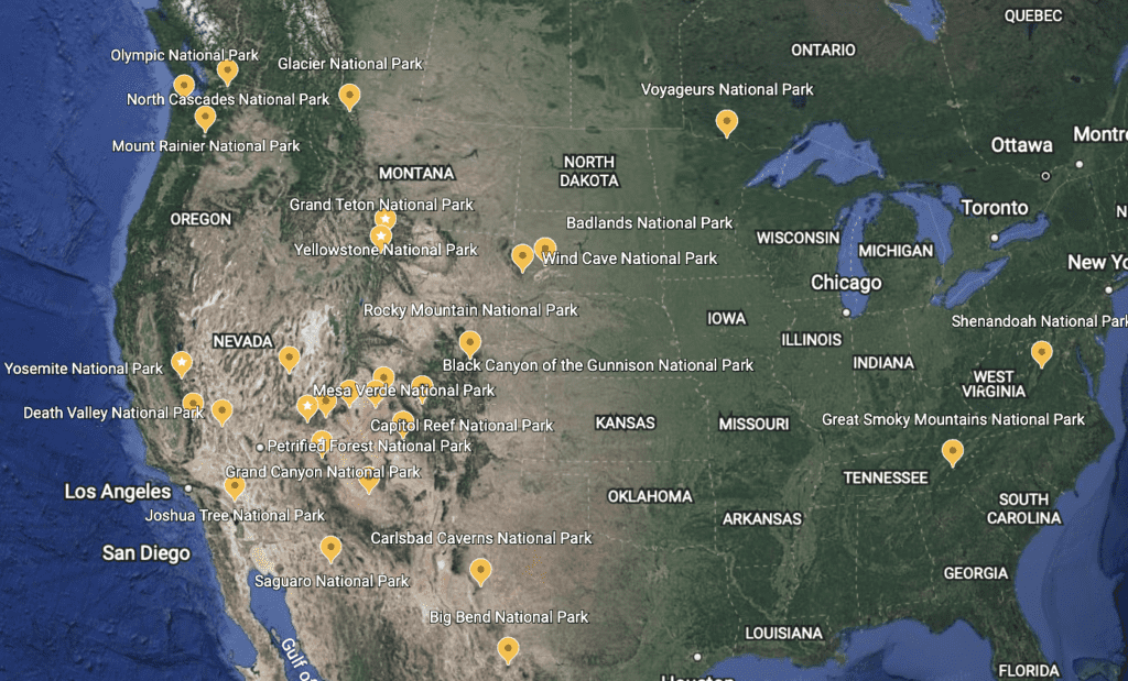
As a class, read National Parks of the USA together. This books explores all the National Parks in the United States with information about the animals, plants, and history of each park.

After reading the book, students will pick a park (pins on GoogleEarth) to find more information about.

They will research the animal’s habitats at each park and their interrelationship with nature. (I chose 32 National Parks, about the size of a classroom so every student does 1)

Research topics: Animals that live there, their habitat, their diet, their characteristics, threats challenges they face, adaptations they have made to that habitat, etc.

Google Earth

Featured Image: Max Pixel

Descriptive World Writing

Map Photo by Kelsey Knight on Unsplash

This lesson is for third graders to practice their descriptive writing. Students will pick a landmark, city, or destination from one of the flagged markers on the attached MyMaps page (or find their own) and use the photo to write a descriptive paragraph about it (without using the landmark’s name) to see if their classmates can figure out what they are describing.

After picking their location, students will have 30 minutes to research, explore the photo, determine essential details, write and edit their descriptive paragraph. Students will want to make sure they use enough descriptive words to paint a mental picture in their audiences’ minds without outright saying the location’s name.

Then students will work in groups to read out their paragraphs and see if the group members can guess what location they are describing. All students have access to the MyMaps for hints, but students can pick their own location not tagged in the post to make it trickier.

This activity will allow students to practice descriptive language and see how people interpret their writing.

This activity could stretch longer if students want to revise their initial paragraph after their first presentation to add or change their location description and then try again with another group.

MyMaps was great to use for this lesson because it allowed me to build a map with pictures and location titles quickly. I could also write a description of each place for the student if I were doing the lesson for younger kids that include grade-level friendly vocabulary. MyMaps allows students choice to pick their location from the pinned spots or select their own.

World Traveling Through Family History

Grade: 5th

Subject: Social Studies

Goal: Students will work to learn the geography of different countries their family is from, this will teach them the importance of history and how it connects to geography.

Instructions:

  1. Have students create their family tree for homework alongside their parents. Ask questions about ancestors and countries they have emigrated from.
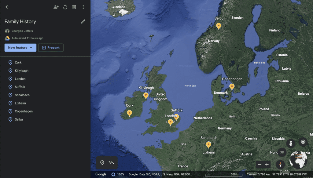
  2. In class students will use Google Earth to highlight some of the birthplaces and hertiage sites for their family history.
  3. Class will then end with students presenting their own Google Earth to the class and interesting information they learned about their family and geopgraphic locations and the importance of those places for human populations.

drive.google.com/file/d/1f9Nqvn6GBtYH4j_C5n6pI-opooHhu9iO/view?usp=sharing

Source:

Photo by NASA on Unsplash

Mission Mapping

Photo by David Vives on Unsplash

Target Student Group: 4th grade, social studies & math

Instructions for students: Take time to explore this interactive map, which shows the 21 California Missions. Each location on the map shows one of the missions and includes a short description, photos, and even videos. While exploring the missions, pick your favorite one because we will be making dioramas of them in the next few weeks. But for now, start exploring the map.

Also, pick 5 pairs of Missions that are adjacent to one another. For example, Mission San Juan Capistrano is adjacent to Mission San Gabriel Arcángel. Using the map, see how many miles apart they are. These two missions are 27 miles apart. Then, we will do some math with this. If it took you 22 minutes to walk one mile, how many hours would it take to walk between these two missions? Multiplying 22 minutes/mile by 27 miles gets you 594 minutes or 9.9 hours (which you get by dividing 594 minutes by 60, which is the number of minutes in an hour). Now, repeat this process but pick different pairs of missions that are adjacent to one another and find out how long it would take to walk between them based on how far apart they are and based on a 22 minutes/mile walking pace.

Goal for the lesson & how MyMap helps meet that goal: The goal of this lesson to teach students about the California missions, which is a key element of the social studies curriculum for California 4th graders. This lesson also gives students multiplication and division practice which is very important in 4th grade. This map helps meet these goals by engaging students in the content, giving them resources to learn about the missions, and having them practice math skills with an element of choice (since they get to pick which adjacent missions to solve with).

Let’s Take a Trip to the Grand Canyon!!

Grand Canyon Photo by Tim Hart on Unsplash

Target Student Group: 1st Grade

Instructions: Students will listen to a read aloud of Grand Canyon by Jason Chin. The students will then share with the class an interesting fact of what they learned through the read aloud. The students will then gather around the carpet and we will go on a virtual field trip to the Grand Canyon as a class.

Goal for this lesson: Students will learn about the geographical features of a canyon and explore the largest canyon in the United States. Google MyMaps helps meet this goal by letting the students explore the natural wonders of the Grand Canyon.

YouTube Read-Aloud:

Grand Canyon Virtual Field Trip (Google MyMap):