
Context: 3rd grade, geography
Goal: For students to understand Oregon’s geography more in depth. 3.8: Use geographical tools (maps, satellite images, photographs, Google Earth, and other representations) to identify multiple ways to divide Oregon into areas (such as tribal, river systems, interstate highways, county, physical, industry, agricultural).
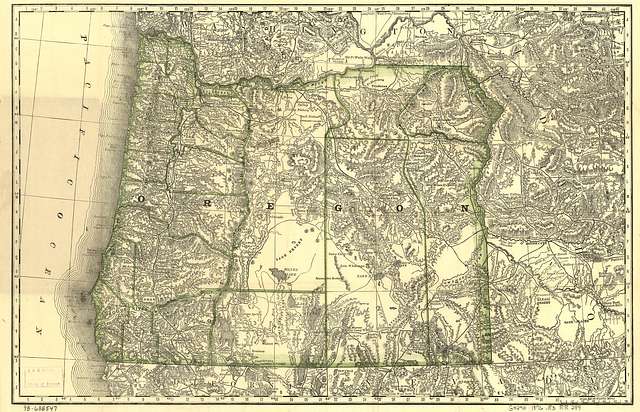
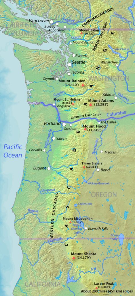
Hello 3rd graders! Use this interactive map below to show the rivers and mountains in Oregon.
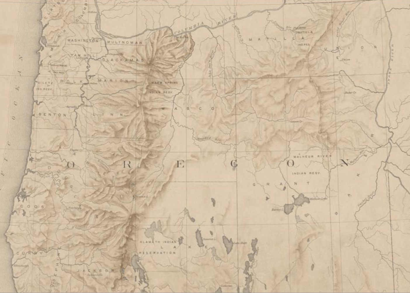
Right: https://picryl.com/media/map-of-oregon-rivers-and-lakes-1ee481 Left: https://nypl.getarchive.net/media/map-of-oregon-territory-probably-prepared-for-the-tenth-census-of-the-united-af7c07
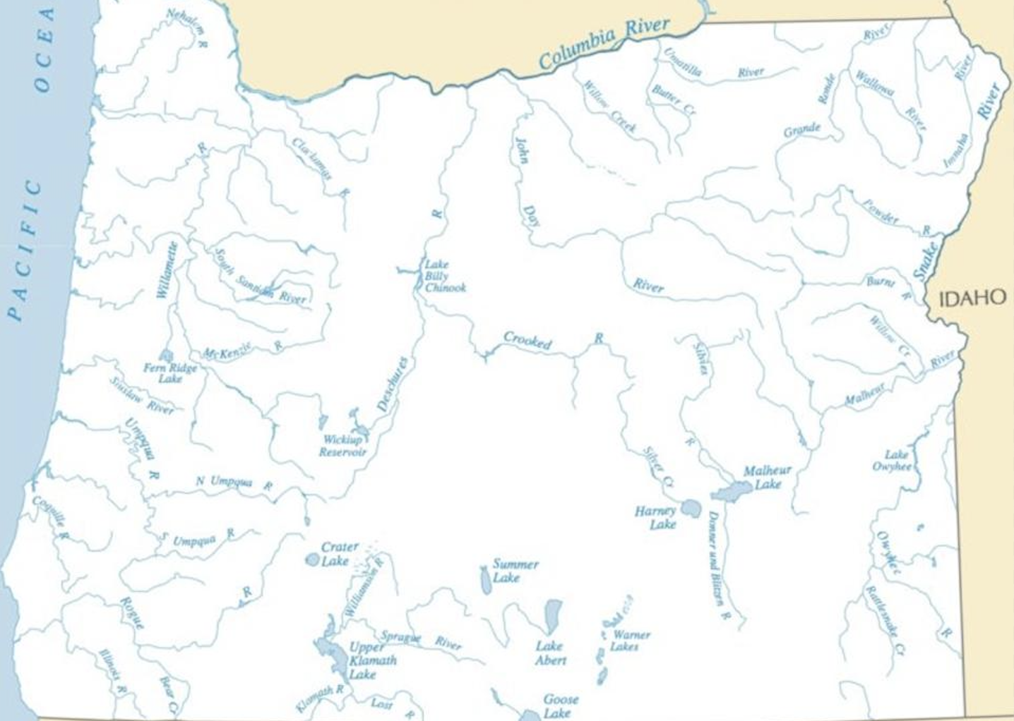
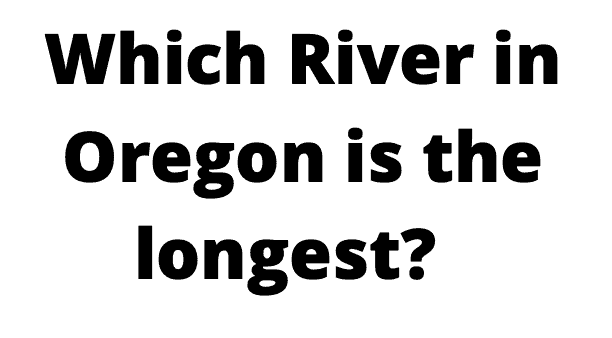
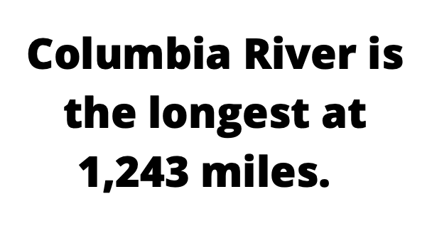
Which River looks the longest?
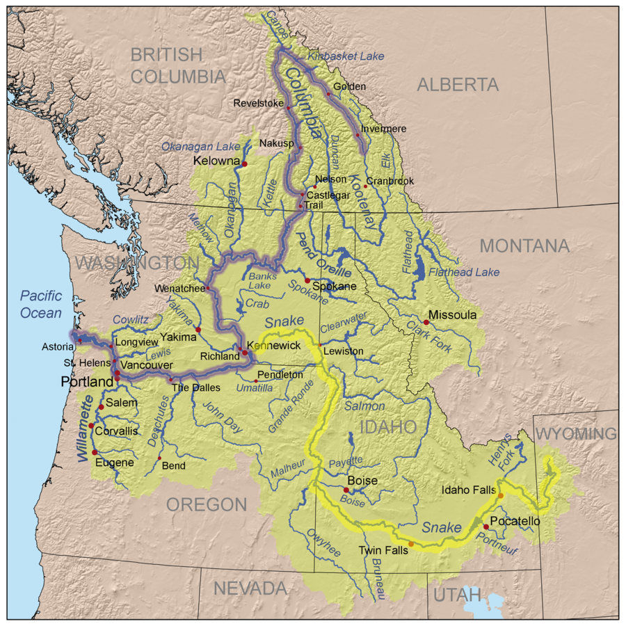
2nd picture: Kmusser, CC BY-SA 3.0 https://creativecommons.org/licenses/by-sa/3.0 3rd picture: Steven Pavlov https://commons.wikimedia.org/wiki/User:Senapa
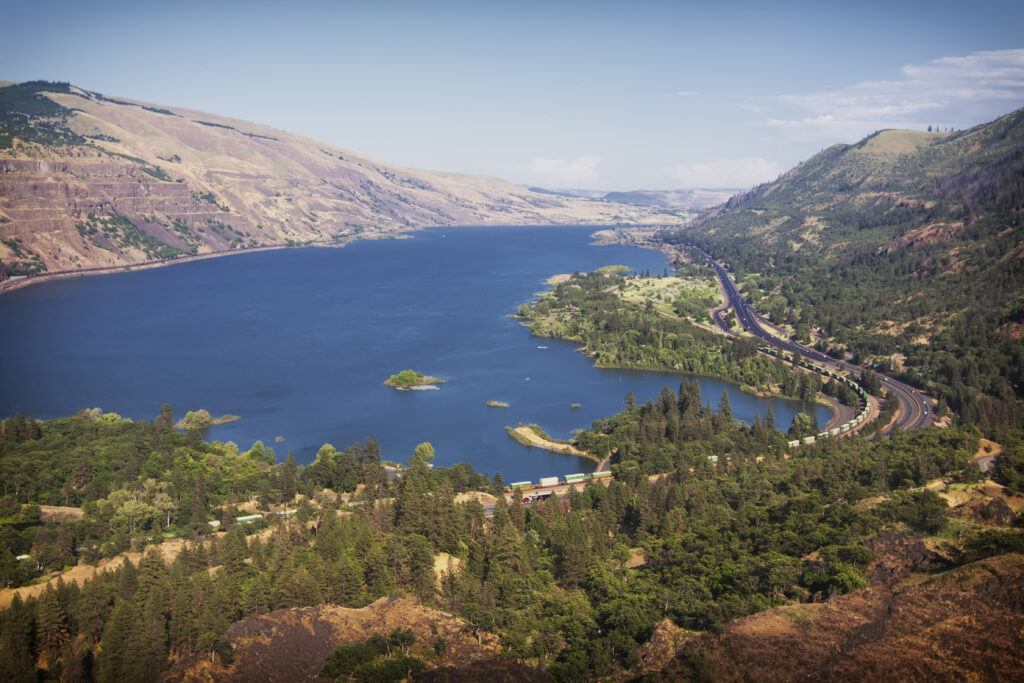
Looking at the map above picture again, answer this question:

2nd Picture: Tony Fischer https://flic.kr/p/5C4B1m 3rd Picture: Shannon https://creativecommons.org/licenses/by-sa/4.0


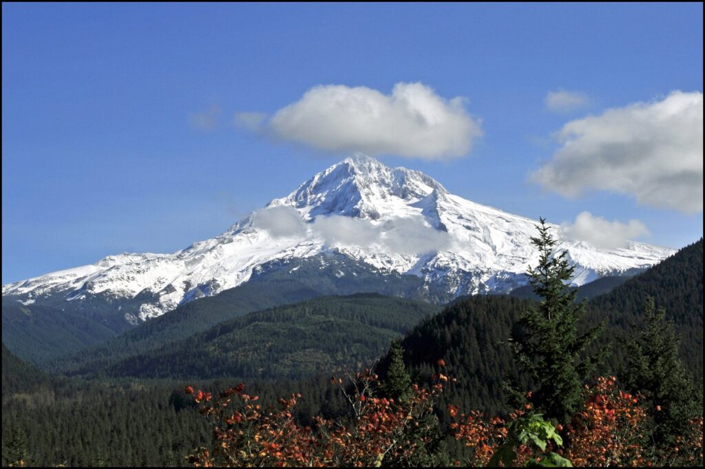
1st: Robert Ashworth, CC BY 2.0 https://creativecommons.org/licenses/by/2.0, via Wikimedia Commons, 2nd: Michael McCullough https://creativecommons.org/licenses/by/2.0, 3rd: Bonnie Moreland https://www.flickr.com/photos/icetsarina/48374782311
Next class we will learn more about Oregon’s beautiful geography through exploring Google Earth: https://earth.google.com/web/@45.36949114,-121.70322197,2997.55911547a,4184.37327762d,35y,39.19864856h,44.77928334t,0r
Featured Image: https://picryl.com/media/indexed-map-of-oregon-showing-the-railroads-in-the-state-and-the-express-company
Jenna,
First off – you did a fantastic job aligning the two Oregon maps. Since they came from different sources, I’m betting you had to get in and make some adjustments to get just right.
It’s an interesting lesson that considers two questions based on the maps. The slide shows do a nice job of illustrating both answers and share some photographic context.
Well done!
Hi Jenna, I LOVE your lesson regarding geography. Your use of slideshow is so helpful when following your lesson plan with images, really gives you an idea of the content of the lesson at hand. I also like how you highlight the use of interactive maps to help students grow an even deeper understanding. Google Earth will be crucial in teaching the geography of Oregon so love to see it as a resource for your lesson. Great job!
Hey Jenna! I think that children living in Oregon would really enjoy learning about their local geography, so this would be a fun lesson for them. Since I just moved to Oregon for college, even I got to learn some new things through your lesson!